County

International

Clifton v Sydney College 1872
Clifton v Sydney College Oct 1873
Gloucester v Clifton Dec 1873
Clifton v Gloucester Jan 1874
Clifton v Sydney College Nov 1874
Clifton College v Clifton Dec 1874
Clifton v South Wales Jan 1878
Gloucestershire v Somerset Jan 1879
Newport v Clifton Jan 1880
Clifton v Cardiff Feb 1881
Gloucestershire v New Zealand Maoris Feb 1889
Clifton v Bristol United Feb 1888
Clifton v Bristol March 1889
Clifton v Bristol Dec 1889
Clifton v Bristol March 1890
Clifton College v Middlesex Wanderers 1891
Clifton v Taunton Sept 1892
Clifton v Bristol Sept 1893
Clifton v Bristol April 1897
Gloucester v Clifton Sept 1903
Gloucestershire v Australia 1908
Bristol/Clifton v Australia Jan 1909
Gloucestershire v Yorkshire Apr 1910
Somerset v South Africa 1912
Clifton v Bristol Nov 1921
Bristol v Clifton Sept 1932
Clifton V Bristol March 1937
Bristol v Clifton Mar 1954
Harlequins v Clifton Nov 1990
Clifton v Bristol Mar 1992
Clifton v Liverpool St. Helens Dec 1993
England v New Zealand Dec 1997
Richmond v Clifton Apr 2006
Clifton v Bracknell Nov 2008


Coldharbour Lane 1872-1882
Cribbs Causeway 1976-present
Robert Kenneth Gillespie MacEwen
Richard Thomas Duttom Budworth
George Heinrich Frederick Cookson
Christopher William Wordsworth
Charles Anthony Langdon Richards
Stephen Brookhouse Richards
Andrew Christopher Thomas
Internationals

Blues

Captains

Clifton Families

Players

Links

Thank To

World War 1 1914-1918

World War 2 1939-1945

Northern Ireland 2000

Cambridge

Oxford

Noel Milford Henson Atkinson
Friedrich Wilhelm Bartelt
Arthur Norton Hickling Churchill
Arthur Edward Jeune Collins
James Lionel Cathcart Dempster
Edward Martin Panter-Downes
Henry Christopher Elliott
Barcroft Joseph Leech Fayle
Hugh William Littleton Geach
Edouard Herbert Allan Goss
Henry Molyneaux Paget Howard
Arthur Clarkson Rose Kearns
Frederick Terence Hastings Mullaly
Hugh Wharton Myddleton Parr
Edgar Nevill Newark Sellman
Reginald Warren Chetham-Strode
Frederick Cecil Banes Walker


Arthur Acraman Greenslade
Murrey Vernon Peters-Smith
Ernest Henry Broadbent Usher
Clifton Association Football Club
Bristol & Clifton Golf Club
William Stanley Alston Brown
Thomas Hedley Bruce Burrough
Alexander Kaye Butterworth
Sir Alfred Hubert Roy Fedden
William Gilbert Grace Jnr
Herbert Willis Reginald Gribble
Thomas Walker Hobart Inskip
Henry Lawrence Weekes Norrington
1880-81 George Montagu Butterworth
1881-82 Alan Douglas Greene
1882-83 Graeme Vassal Cox
1885-86 Henry Cecil Montague Hirst
1886-89 Hiatt Cowles Baker
1891-92 William Henry Trenley Birch
1892-93 Edward Payne Press
1893-96 William John Lias
1896-97 William Edgar Paul
1901-03 Francis John Hannam
1907-09 Ellison Fuller-Eberle
1911-13 Victor Fuller-Eberle
1913-14 Joseph Albert Dommett
1921-24 Frank Manning Arkle
1948-51 George Edward McWatters
1925-26 Clifford Newberry Hatcher
1951-52 Roger Alan Malcolm Whyte
1952-54 Benjamin A. Tuttiett
Bevan Stanishaw Chantrill
Stephen Brookhouse Richards
Robert Kenneth Gillespie MacEwen
Lionel Arthur Edward Ollivant
 |
Clifton
Rugby Football Club History |
|
Grounds
- Coldharbour Lane 1872-1885
|
ADVERTISE ON THIS WEBSITE |
Founders  Benefactors  Famous Players  Famous Matches  Grounds  War Memorial  Statistics  Other Sports  Info  |
List of Club Members 1872-1945  Club Statistics 1872-2011 |


Above left 1870's map of Bristol. Above right,
close-up of Downs area. Coldharbour Farm marked in pink.
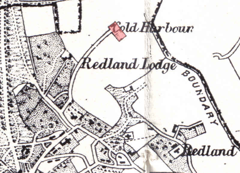
Above a close-up of the land around Coldharbour
Farm in 1870 which was Clifton's first pitch. To confuse matters a modern day Coldharbour
Lane now exists several miles away at the University of the West of England.
The name of Coldharbour Lane was changed to Coldharbour Road in 1904. Its difficult
to know where the exact pitch was as we only have the description of "on
the corner of Coldharbour Lane, near the farmhouse".
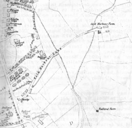

Above left Ashmead's map of 1882 gives a little more
detail. Above right map of 1888.

Above map dated 1885 drawn
for the extension of the borough boundaries.
There are stories that Coldharbour Farm was
the site of a Roman Villa but no evidence has been found yet. Although the name
Coldharbour means a shelter for travellers and is also an old name that signifies
a Roman villa near an old road. In Coldharbour Lane itself there were just 6
cottages, the Cambridge Arms (then a small, two winged building) and the farm
at the end. The cottages were lived in by two gardeners, a bootmaker, a coachman,
a haulier and a laundress. John Martin, from Chew Magna, was the farmer and
he lived there with his wife, two unmarried daughters and a niece who worked
as a dairymaid. The gamekeeper's cottage was empty. These people served the
local area of wealthy families living in the large houses in Cambridge Park
and facing the Downs. The Cambridge Arms still exists although the present building
is of 1900, designed by Edward Gabriel, see below.
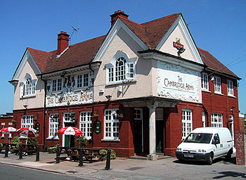
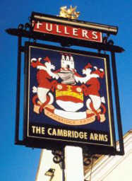
Listed as Landlord of the Cambridge Arms
at the time is John E Williams. We had a A.J.E.Williams listed as a player from
1872-73. John Williams was landlord of the Cambridge Arms from 1865-78.
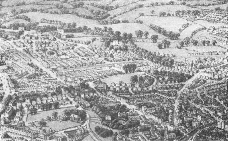
Above drawing c.1887 of Redland Court (now
Redland High School for Girls) (middle third down) and its surroundings. The
drawing is very confusing as a lot of the buildings have no detail but I would
say Coldharbour
Lane runs
at 45 degrees in the top left hand corner of the picture.

Above photograph of Coldharbour Lane taken
between 1900 and 1914 shows the rebuilt Cambridge Arms and the old cottages
still surviving.
The first match at Coldharbour was against Sydney College click here
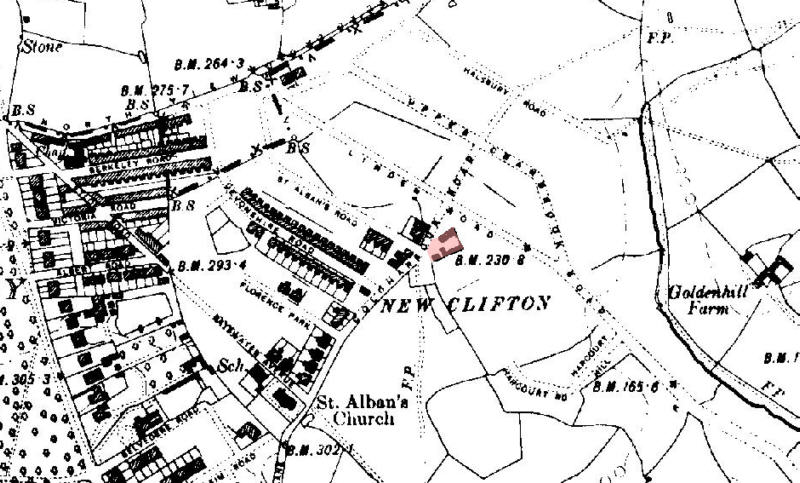
Ordnance Survey 1:10560
County Series 2nd edition (c.1900) Sheet 03 Subsheet 10 map , part of Coldharbour
Farm, marked pink, still exists although the road network has been marked out
ready for New Clifton, later to become part of Westbury Park.
Reproduced from the (1900) Ordnance Survey map. © Crown copyright.
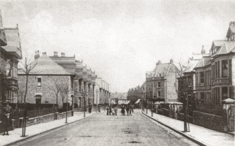
Above Coldharbour Road c.1907.
The turning on the left is Devonshire Road. Further along on the right the 3-storey
house and shop stand on the site of the former Coldharbour Farm, Greendale Road
is on the right.
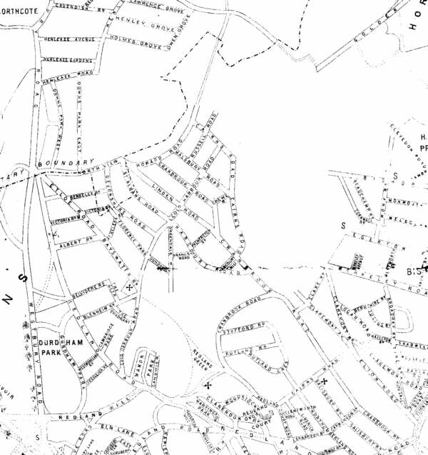
Above map of the area dated 1912. The farm now built over with housing.
In 1882 we moved to Durdham Down click here


